
Hurricane Dorian Makes Catastrophic Landfall as a Category 5 in Northwest Bahamas; Hurricane Watches Issued in Florida
By weather.com meteorologists
At a Glance
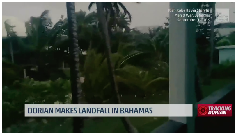
- Dorian is hammering the northwest Bahamas as a Category 5.
- A life-threatening storm surge of up to 23 feet is possible there.
- Wind gusts of over 200 mph are possible in parts of the northwest Bahamas.
- A hurricane watch and a tropical storm warning have been issued for a part of Florida’s east coast.
- Dorian is a threat for the Southeast from Florida to North Carolina this week.
- What part of the coast experiences hurricane conditions remains uncertain, dependent on the exact track.
- Residents along the Southeast coast should have their hurricane plans ready and monitor Dorian closely.
Hurricane watches have been issued for a portion of Florida’s eastern coast as Dorian makes a catastrophic strike as a Category 5 in the northwest Bahamas. The dangerous hurricane is still a threat to Florida, Georgia, South Carolina, North Carolina and southeast Virginia.
Dorian made landfall on Elbow Cay in the Abacos of the northwest Bahamas at 12:40 p.m. EDT.
Maximum sustained winds have increased to 185 mph, putting Dorian in a tie for the second-highest sustained wind speed among all Atlantic hurricanes. It also ties the 1935 Labor Day Hurricane (Florida Keys) as the strongest landfalling hurricane in the Atlantic basin.
(The highest cloud tops, corresponding to the most vigorous convection, are shown in the brightest red colors. Clustering, deep convection around the center is a sign of a healthy tropical cyclone.)
Dorian was upgraded to Category 5 status Sunday morning after an Air Force Reserve Hurricane Hunter mission confirmed winds had increased above 157 mph.
(INTERACTIVE: Current Bahamas Winds, Satellite)
The northwest Bahamas are taking the brunt of Dorian’s eyewall right now. A wind gust to 100 mph has been reported in Hope Town in the Abacos of the northwest Bahamas, according to the National Hurricane Center (NHC).

Watches and Warnings
A hurricane warning is in effect for much of the northwestern Bahamas, including Freeport, Grand Bahama, and Nassau, New Providence Island. Andros Island is in a hurricane watch.
A hurricane watch and storm surge watch are now posted for a portion of Florida’s eastern coast, from north of Deerfield Beach to the border between Volusia and Brevard counties.
A hurricane watch is issued when hurricane conditions (winds 75-plus mph) are possible in the watch area. They are posted 48 hours before the first tropical-storm-force winds are expected. The storm surge watch means that a life-threatening inundation is possible in the area during the next 48 hours.
A tropical storm warning is in effect along the east coast of Florida from north of Deerfield Beach to Sebastian Inlet, meaning tropical-storm-force winds (39-plus mph) are expected within 36 hours. This warning includes West Palm Beach.
A tropical storm watch is in effect for portions of the east coast of Florida from north of Golden Beach to Deerfield Beach as well as Lake Okeechobee.
Tropical storm watches mean winds of 40 mph or greater are possible within 48 hours. This watch includes Ft. Lauderdale and Hollywood, Florida.
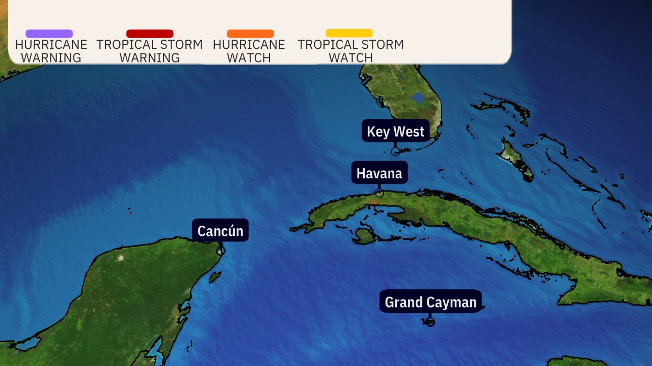
(A watch is issued when tropical storm or hurricane conditions are possible within 48 hours. A warning is issued when those conditions are expected within 36 hours.)
Below is the latest on Dorian’s timing and what we know about potential forecast impacts right now.
Dorian’s Forecast Timing
Sunday: Dorian’s hurricane siege will continue in the northwest Bahamas as it continues to slow down. Large swells should begin to arrive at the coast from North Carolina to Florida.
Monday: Dorian will still be hammering the northwest Bahamas as it crawls slowly. Bands of rain, strong winds may affect parts of Florida. Tropical storm-force winds are expected in the tropical storm warning area of eastern Florida. How strong the winds will be depends on how close the center of Dorian is to the Florida coast, which is still uncertain at this time. Battering waves, coastal flooding and beach erosion will increase along the southeast coast of Florida.
Tuesday: Dorian will still be hammering the northwest Bahamas, but conditions, there may slowly improve by night. Bands of rain, strong winds will still affect parts of Florida. Tropical storm-force winds are expected in the tropical storm warning area of eastern Florida. We cannot rule out the potential for hurricane-force winds, depending on how close the center tracks to the coast. Coastal flooding and beach erosion will spread north along the Florida coast.
Wednesday-Thursday: Dorian is expected to move north, then northeast near the coasts of northeast Florida, Georgia, South Carolina and North Carolina. The exact track is very uncertain, ranging from a track far enough offshore to keep hurricane force winds away from land, to a landfall anywhere in this zone. Storm surge flooding, damaging winds and flooding rain are all possible in these areas.
Friday-Saturday: Dorian is then expected to race off the Northeast Seaboard, but could track close enough to bring rain and some wind to the Virginia Tidewater, Nantucket, Martha’s Vineyard and Cape Cod, before it heads toward the Canadian Maritimes by next weekend.

(The red-shaded area denotes the potential path of the center of Dorian. It’s important to note that impacts – heavy rain, high surf, coastal flooding and winds – with any tropical cyclone usually spread beyond its forecast path.)
Dorian’s Track Uncertainty
Uncertainty continues to be high when it comes to exact forecast impacts in the southeastern U.S. However, all interests from Florida to Georgia, the Carolinas and southeast Virginia should have their hurricane plans ready and monitor the forecast of Dorian closely.
The myriad of track possibilities range from a Florida landfall and track northward through part of the Florida Peninsula to a landfall somewhere in the Carolinas to a scrape of the Southeast coast without the center ever moving ashore to a sharper northeast turn well offshore.
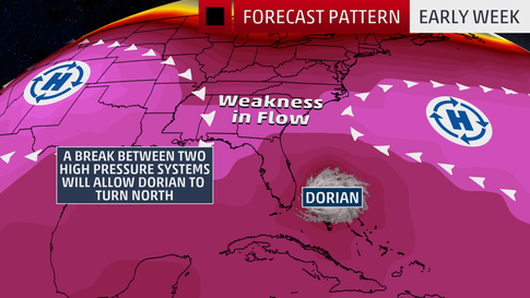
The uncertainty in Dorian’s exact track is mainly related to an area of high pressure off the East Coast when it fizzles.
That Bermuda high is currently steering Dorian toward the west, but will weaken soon, leaving Dorian stuck for a day or two, after which it then is expected to turn north, then northeast as a southward dip
Exactly when it makes those north and northeast turns is critical. If those turns occur later, it’s more of a landfall danger for parts of the Southeast coast. If it makes those turns sooner, the threat of a landfall is less, particularly in Florida and Georgia.
Regardless of its exact track, Dorian is likely to be a dangerous hurricane when it nears the U.S. Southeast coast.
Furthermore, as we saw with Hurricane Matthew in 2016, a hurricane doesn’t have to make landfall in an area to produce significant impacts.
Dorian’s Storm Surge, Wind and Rain Impacts
Bahamas
In the northwestern Bahamas, a life-threatening storm surge may cause water levels to be as much as 18 to 23 feet above normal tide level in areas of onshore winds. Near the coast, that storm surge will be accompanied by large, destructive waves.
Wind gusts over 220 mph are possible in the Abaco Islands, according to the NHC.
Rainfall totals of 12 to 24 inches are expected in the northwestern Bahamas, with isolated amounts up to 30 inches, which may cause life-threatening flash flooding, the NHC said. The central Bahamas can expect 2 to 4 inches, with isolated totals up to 6 inches.
Southeast U.S.
Larger swells and increased battering waves generated by Dorian should begin to arrive along the Southeast coast from North Carolina to eastern Florida Sunday, and will persist for several days.
This will lead to increasing beach erosion and coastal flooding, particularly around times of high tides, which are generally around 10 to 11 a.m. and p.m. each day.
These impacts will occur regardless of whether Dorian’s center ever moves ashore in any part of Florida, Georgia or the Carolinas.
It’s too early to know the exact magnitude and location of any impacts from storm surge, damaging winds or flooding rainfall at this time in Florida and the rest of the Southeast, given the track uncertainty.
(MAS: Dorian en Español)
The NHC says water could reach the following heights above ground level in eastern Florida if the peak surge coincides with high tide.
-Volusia/Broward County line to Jupiter Inlet: 4-7 feet
-North of Deerfield Beach to Jupiter Inlet: 2-4 feet
That said, this storm surge forecast will likely change depending on how close Dorian tracks to Florida.

(From the National Hurricane Center.)
The worst wind impacts will occur within the hurricane’s eyewall, while the highest storm surge will occur immediately to the east or north of where the center makes landfall, assuming it does at all. Again, it is not possible to determine exactly where these will occur at this time.
In Florida, tropical storm force winds will arrive along the coast well ahead of Dorian’s closest pass, making preparations difficult.
Use the times listed below as the time you need have preparations completed.
(Tropical-storm-force winds are winds of at least 39 mph.)
Here are the latest rainfall projections from the NHC and NOAA’s Weather Prediction Center:
-Coastal South Carolina and North Carolina: 5 to 10 inches, locally up to 15 inches.
-Near Florida’s Atlantic coast through eastern Georgia: 2 to 4 inches, locally up to 6 inches.
Should the storm track farther offshore, these rain amounts will be less. And if the track is more inland, this rain footprint would also include areas farther inland.

(This should be interpreted as a broad outlook of where the heaviest rain may fall. Higher amounts may occur where bands or clusters of thunderstorms stall for over a period of a few hours.)
For now, the entire Florida peninsula and the Southeast coast need to be on high alert this week.
If you live in an area prone to storm surge, be sure to follow the advice of local officials if evacuations are ordered.
Check back with weather.com for the latest on Hurricane Dorian.